GradeMetrix® Machine Control & Guidance Positioning System Solutions
Dozer Solution
Compact Excavator Solution
Large Excavator Solution
Scraper Solution
Track Loader Solution
Loader Solution
Hemisphere GNSS GradeMetrix | SiteMetrix
VIEW PRODUCTS
GradeMetrix is Hemisphere GNSS’ high-value machine guidance solution for high-precision GNSS-based machine control and guidance applications and systems. Hemisphere’s GradeMetrix portfolio includes solution offerings for dozer and excavator earth-moving applications. Hemisphere continues to make significant strides forward with its next-generation GradeMetrix solutions through its network of machine control dealers and value-added resellers. Whether it is grading, mining, excavating, or compaction applications, GradeMetrix solutions provide superior performance at an exceptional value.
Dozer Solution Key Features:
- Dynamic cut/fill to tracks or blade
- Simplified User Interface
- Multiple Views
- Supports industry standard file formats including: dwg, dxf, LandXML
- Stake points
- In-field design
- Build flat pads
- Build single, dual, or multiple slopes
- Global map projections
- 3-year warranty
Compact & Large Excavator Solution Key Features:
- Dynamic cut/fill to tracks, or bucket
- 2D, 2.5D, 3D operation modes all standard
- Supports tilt bucket option
- Supports laser receiver option for higher accuracy elevation demands
- Simplified User Interface
- Multiple views include plan, profile, cross-section and more
- Supports industry standard file formats including: dwg, dxg, LandXML
- Stake points
- In-field design
- Build flat pads
- Build single, dual, or multiple slopes
- Global map projections
- 3-year warranty
Ruggedized Hardware
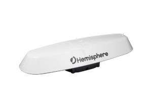
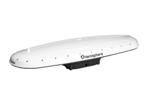
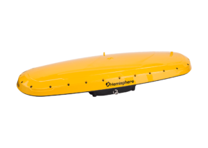
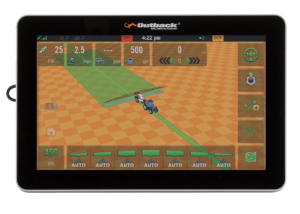
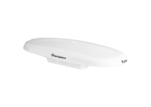
Our complete guidance solution is powered by the VR500 all-in-one smart antenna. The VR500 has undergone extensive shock, vibration, and environmental testing to ensure that it is ready to stand up to the harshest job site conditions. The IronOne rugged display features an 8” high- brightness touchscreen display for visibility in direct sunlight.
Access to Advanced Technology Features
Hemisphere’s Atlas is an innovative positioning service that delivers correction signals via L-band satellites at scalable accuracies ranging from sub-meter to sub-decimeter levels. Leveraging more than 200 reference stations worldwide and L-band satellites distributing corrections, virtually all the earth’s landmass has coverage. Atlas support is available on all Atlas-capable Hemisphere single and dual-frequency, multi- GNSS, RTK-capable hardware.
Atlas compliments third-party GNSS receivers by allowing them to use Atlas corrections with Hemisphere’s innovative BaseLink® capabilities. Also included is Hemisphere’s aRTK™ technology. aRTK is an Atlas-based RTK augmentation system that provides RTK-level accuracy, availability, and reliability when RTK corrections fail.


Contact Our Team
Need to chat? Complete the form below and we will respond within 24 to 48 business hours.
Related Products
A631 GNSS Smart Antenna
- Scalable Dual-Frequency, Multi-GNSS
- GPS, GLONASS, BeiDou, and Galileo
- Athena™ RTK, Atlas® L-Band, and SBAS-Capable
- 800+ Channels
- 10 Hz Update Rate (20 Hz Optional)
OEM Development Kit ST
OEM Development Kit ST The Universal Development Kit ST allows you to integrate a Hemisphere GNSS OEM board into your design. The Universal Development Kit ST supports the following Hemisphere GNSS OEM boards:
- Vega™-based OEM boards
- Phantom™-based OEM boards
Related Products
Vector™ V123 & V133 GNSS Smart Antennas
- Single-Frequency, Multi-GNSS
- GPS, GLONASS, BeiDou, Galileo, and QZSS
- Atlas® L-Band, Beacon (V133), and SBAS-Capable
- 511 Channels
- 20 Hz Update Rate (50 Hz Optional)
- 0.3º Heading Accuracy
Vector™ V500 GNSS Smart Antenna
- Designed Specifically for Marine Applications
- Multi-Frequency, Multi-GNSS
- GPS, GLONASS, BeiDou, Galileo, QZSS, and IRNSS
- Athena™ RTK, Atlas® L-Band, and SBAS-Capable
- 1100+ Channels
- 10 Hz Update Rate (20 Hz Optional)
- 0.27º Heading Accuracy
Vector™ VR500 GNSS Smart Antenna
- Designed Specifically for Construction & Mining Applications
- Multi-Frequency, Multi-GNSS
- GPS, GLONASS, BeiDou, Galileo, QZSS, and IRNSS
- Athena™ RTK, Atlas® L-Band, and SBAS-Capable
- 1059 Channels
- 10 Hz Update Rate (20 Hz Optional)
- 0.27º Heading Accuracy
Phantom™ 40 GNSS OEM Board
- Multi-Frequency, Multi-GNSS
- GPS, GLONASS, BeiDou, Galileo, QZSS, and NavIC (IRNSS)
- Athena™ RTK, Atlas® L-Band, and SBAS-Capable
- 800+ Channels
C631 GNSS Smart Antenna
- Multi-frequency GPS, GLONASS, BeiDou, Galileo, QZSS, IRNSS, and Atlas L-band
- Long-range RTK baselines up to 50 km with fast acquisition times
- UHF (400 MHz & 900 MHz), cellular, Bluetooth, and Wi-Fi wireless communication
- Athena GNSS engine providing best-in-class RTK performance
- Internal sensor corrects collected point coordinates to within 2 cm
LandMetrix™ OEM Agriculture Solution Toolkit
LandMetrix™ OEM Agriculture Solution Toolkit
Introducing Hemisphere GNSS’ new OEM application software and hardware for building your agriculture guidance and control systems.
Vector™ V200 GNSS Smart Antenna
- Single-Frequency, Multi-GNSS
- GPS, GLONASS, BeiDou, Galileo, and QZSS
- Atlas® L-Band and SBAS-Capable
- 511 Channels
- 10 Hz Update Rate (20 Hz Optional)
- 0.75º Heading Accuracy
Phantom™ 20 & 34 GNSS OEM Boards
- Multi-Frequency, Multi-GNSS
- GPS, GLONASS, BeiDou, Galileo, QZSS, and NavIC (IRNSS)
- Athena™ RTK, Atlas® L-Band, and SBAS-Capable
- 800+ Channels
S631 GNSS Smart Antenna
- Multi-frequency GPS, GLONASS, BeiDou, Galileo, QZSS, IRNSS, and Atlas L-band
- Long-range RTK baselines up to 50 km with fast acquisition times
- UHF (400 MHz & 900 MHz), cellular, Bluetooth, and Wi-Fi wireless communication

